Fluvial Geomorphology, Remote Sensing, Geoinformatics, GIS, Geomatics Engineering
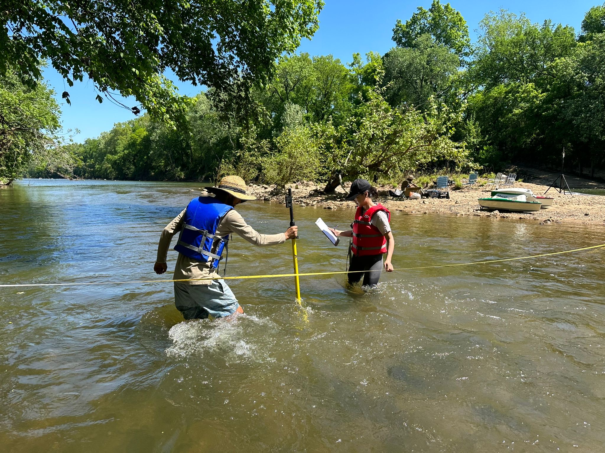
Measuring width and depth of Cahaba river
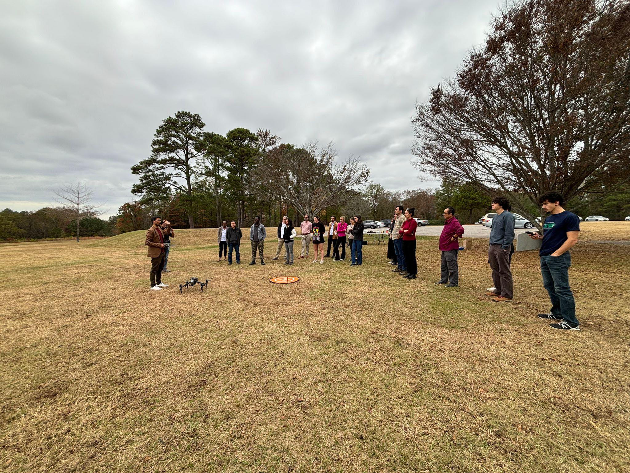
Demonstrate how to fly drones in GIS day
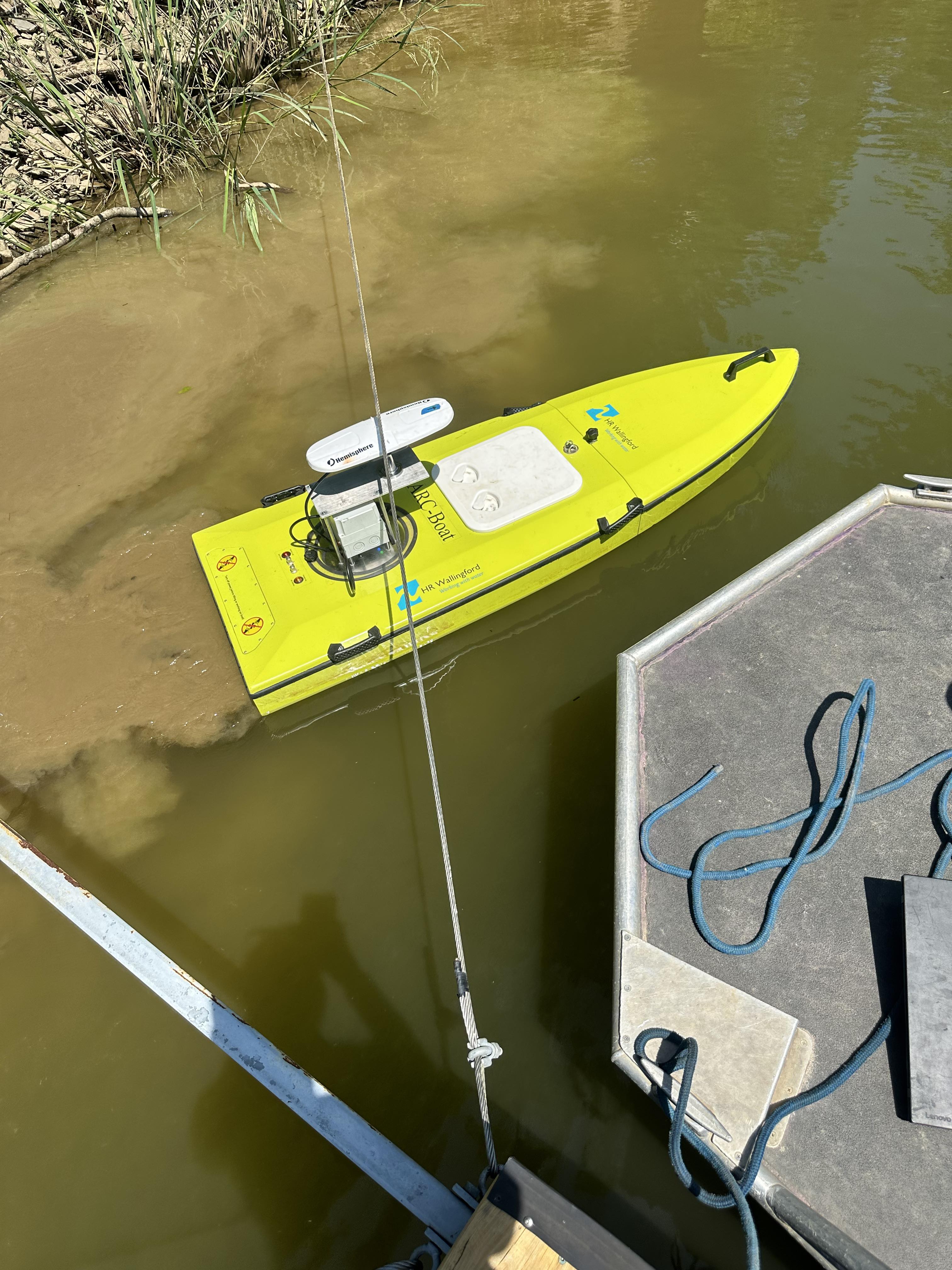
Demonstrate how to operate vessel for water survey
Check it out