Field Survey
Measuring width and depth of Cahaba river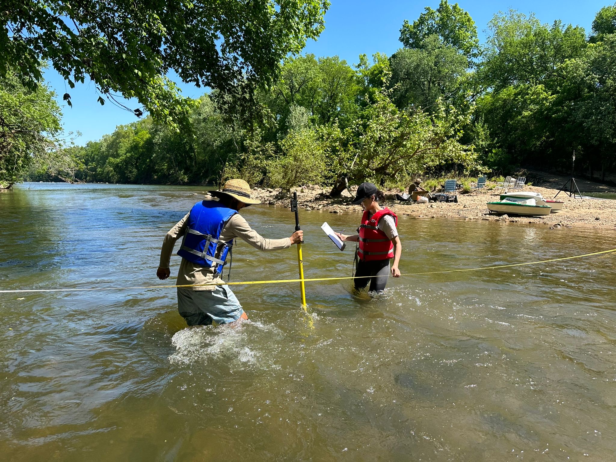
Measuring width and depth of Cahaba river
Demonstrate how to fly drones in GIS day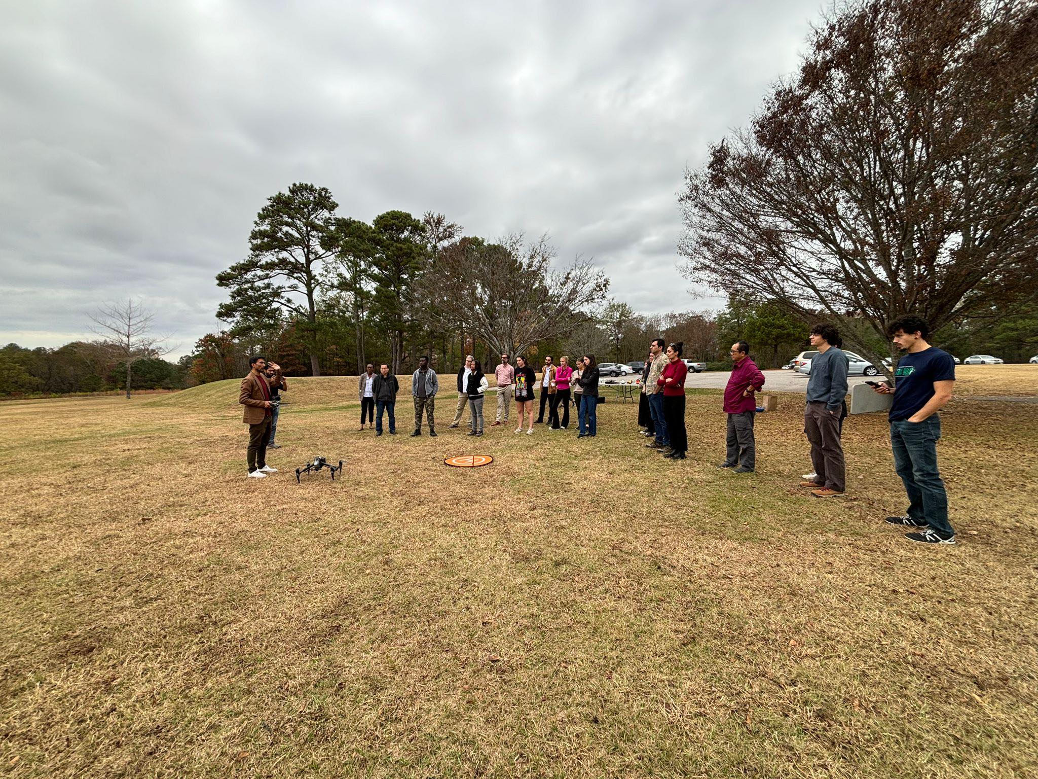
Demonstrate how to operate vessel for water survey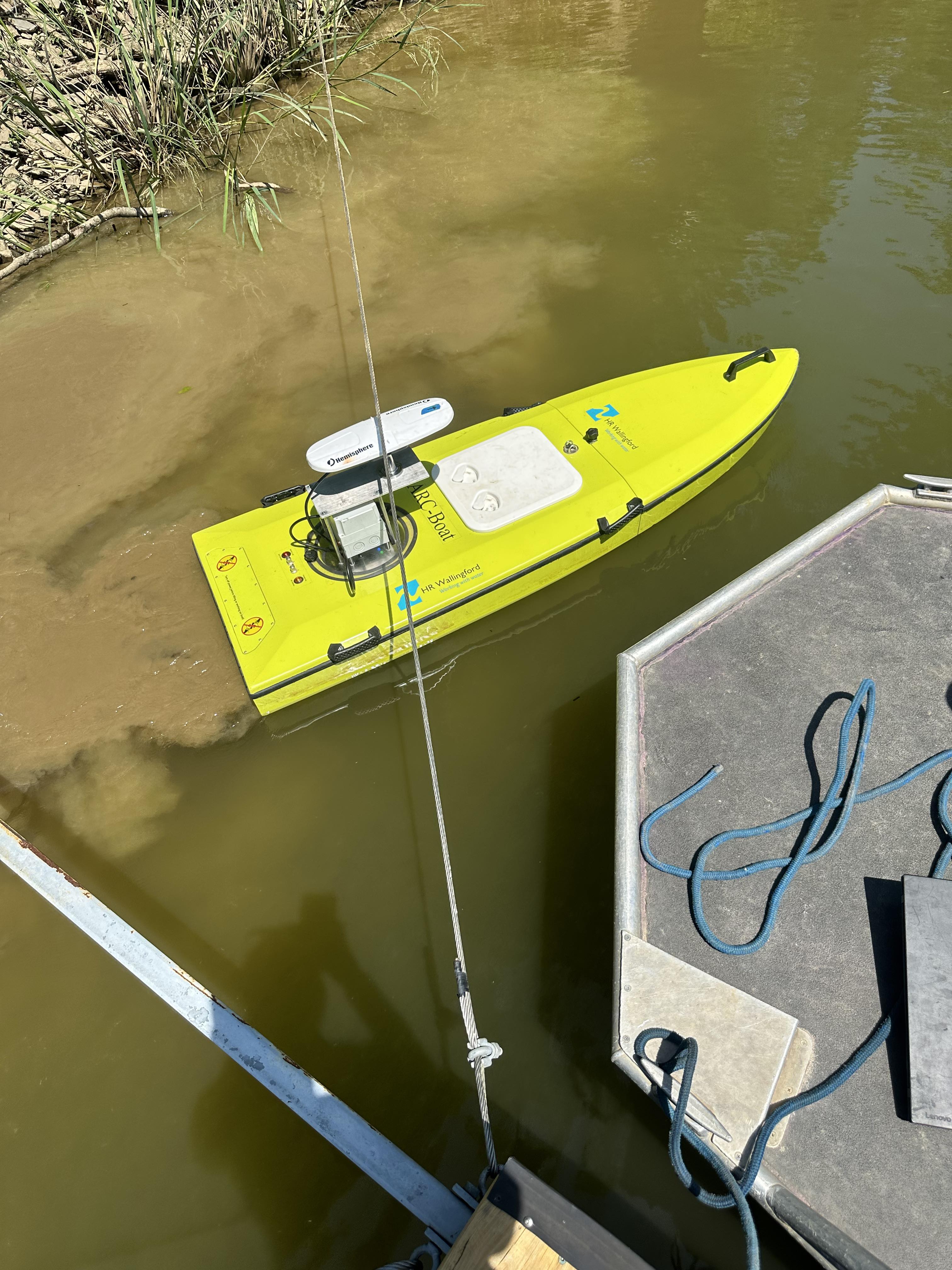
Check it out
Published in Environmental Systems Research, 2020
This paper is about spatial estimation of soil erosion using RUSLE modeling.
Recommended citation: Thapa, P. (2020). "Spatial estimation of soil erosion using RUSLE modeling: a case study of Dolakha district, Nepal." Environmental Systems Research. 1(3).
Download Paper
Published in Review of Behavioral Aspect in Organizations and Society, 2021
This paper is about the number 2. The number 3 is left for future work.
Recommended citation: Thapa, P. (2021). "Paper Potential of Unmanned Aerial Vehicles for Agriculture: A Review." Review of Behavioral Aspect in Organizations and Society. 1(2).
Download Paper
Published in Springer, Cham, 2022
This paper is about the time series analysis and prediction of COVID-19
Recommended citation: Thapa, P. (2022). "Time Series Analysis and Forecast of COVID-19 Pandemic.." Springer, Cham. 1(3).
Download Paper
Published in Earth Surface Processes and Landforms., 2025
This paper is about the modified medial axis transform to detect centerline and estimation width of river
Recommended citation: Thapa, P., et al. (2025). "Enhanced River Planform Analysis Using Deep Learning and Medial Axis Transform with Sentinel 1A Imagery." Earth Surface Processes and Landforms. 1(1).
Download Paper
Published in Conference proceedings for IEEE Region 10 Symposium 2025, Christchurch, New Zealand., 2025
This paper is about the modified medial axis transform to detect centerline and estimation width of river
Recommended citation: Thapa, P. (2025). "MMATWidth: Detection of River Centerlines Extraction and Width Estimation." Conference proceedings for IEEE Region 10 Symposium 2025. 1(1).
Download Paper
Diploma Courses, Banepa Polytechnic Institute, Department of Geomatics Engineering, 2018
Instruction focused on technical surveying competencies and photogrammetric principles for diploma-level engineering students.
Graduate and Undergraduate Courses, Kathmandu University, Dept. of Geomatics Engineering, 2019
Responsible for curriculum delivery and research supervision across Geomatics Engineering, Environment Engineering, Geoinformatics and Land Administration programs.
Undergraduate & graduate Courses, University of Alabama, Department of Geography and the Environment, 2022
Guided students through fundamental geospatial and environmental concepts, focusing on hands-on laboratory exercises and data analysis.